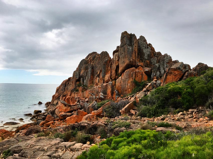
Outcrops and boulders of granitic gneiss are everywhere throughout the Park: they are present on the crests of ridges, as the steep sides of valleys, as rocky escarpments and talus strewn slopes, and as pocket like sandy beaches, boulder beds, wave battered headlands and offshore islands.
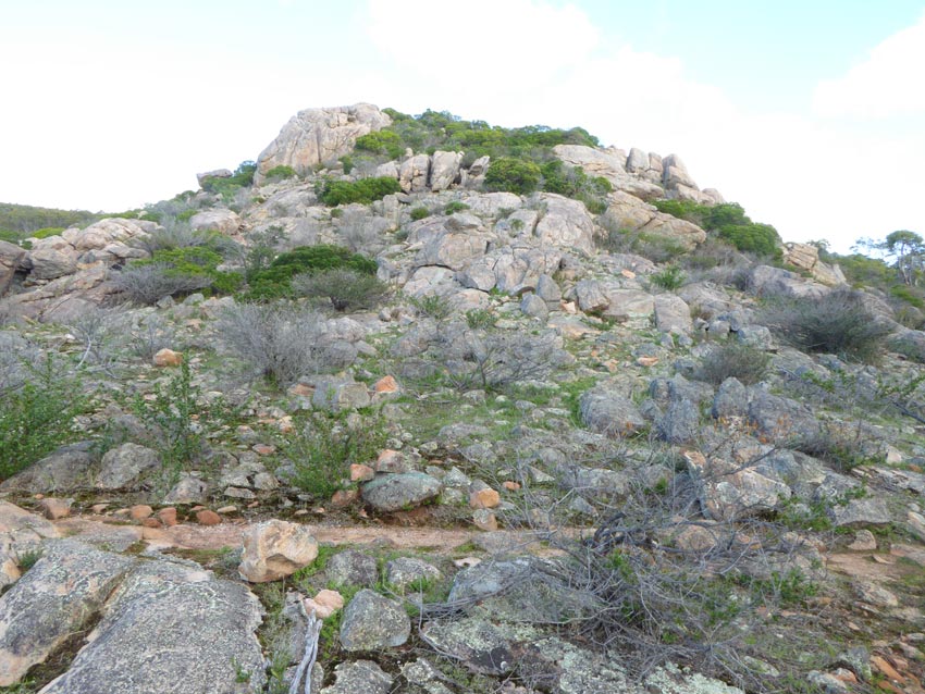
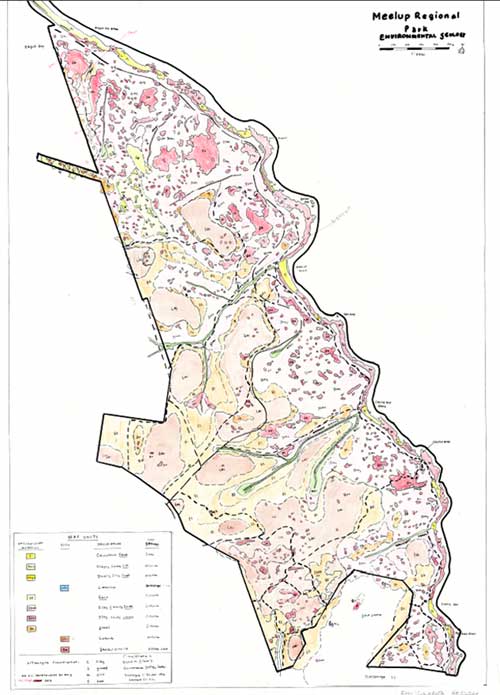 The eastern third of the Park is a mosaic of large, rounded outcrops ( tors, knolls and inselbergs) embedded in a matrix of sandy gravels and clays. These outcrops were exposed when the over-lying soil horizons and broken rock fragments were eroded and removed by stream action and running water. This widespread erosion probably took place when the Park was subjected to heavy rainfall during and the Permian Era, 280 Million years ago. Back then the Meelup and Dolgorup Brooks would have cut down on the granitic gneiss bedrock to develop their deep valleys and 20 degree slopes.
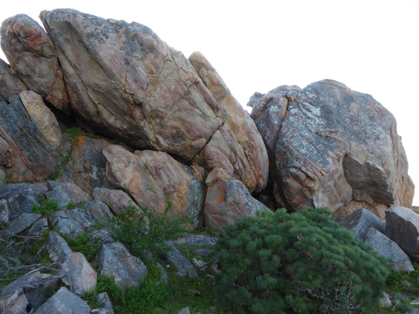
The Park’s granitic gneiss is classed as a granulite of the Dunsborough suite of the Leeuwin Complex. Its metamorphic character is revealed by the alternating bands of quartz, feldspar and pyroxene and by its strongly foliated texture and by its folding and jointing. Intense heat and pressure melted the original granite over a 600 million year period of mountain chain- building (from 530 to 1100 Million years) during the Proterozoic Era when the super continent Gondwana broke- up.
Lateritic hills and plateaus and gravel slopes constitute the western and central thirds of the Park. Laterite is a really a fossil soil and, as such, owes its formation to the chemical weathering of the feldspars of granitic gneiss and the gradual transformation of iron and aluminium hydroxides into gibbsite, boehmite hematite, and maghemite. These secondary minerals were then segregated by subsurface drainage into four zones: the upper zone ( or duricrust) is earthy and hard and cemented by iron, beneath this zone is the friable and mottled zone, which in turn lies above a pallid zone and then the core stones of un-weathered granitic gneiss. In the Park the laterite profile is 0.5 to 1.5 metres thick and is very prone to deteriorate into gravels and sands. The very complicated laterization process probably took place 25 to 40 Million years ago in the Eocene- Oligocene Era when the South West of Western Australia had a tropical climate comparable to that experienced to-day in Indonesia.
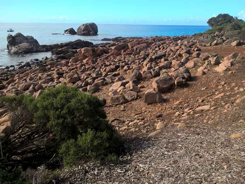
The Park’s four beaches are crest shaped and confined between granitic gneiss headlands; and their beach sand is mainly derived from the material transported by its brooks and streams with additional contributions from long shore drift. The beach sand is a mix of quartz and rock detritus interspersed with shell fragments. Sand is sorted by grain size by gravity, wave currents and winds. Semi-mobile sand dunes line the shore and back-beach margins. Pounding waves and cut into rock joints to expose rock surfaces to leaching of iron and clay mineral by seawater. The position of boulders and cobbles is the result of their shape, the dominant beach profile and tidal movements and storms. Cobbles and pebbles are occasionally cemented by calcium to form beach conglomerates.